Show HN: Isopolis – Isometric pixel map of SF
Posted by nuwandavek 12 hours ago
Comments
Comment by lawrencechen 10 hours ago
https://sf.isopolis.city/dev.html
> The source is Google Photorealistic 3D Tiles. Isometric.nyc explored and rejected the use of 3d building data. It is pretty insane that US gov has free LIDAR data for every city in the US available to the public. I spent <30mins exploring this and stuck to google 3d images. Claude Code whipped up a scraper to stream the 3D Tiles and render with three.js. This gives the best "real" texture base for the model to learn from. Anything else would involve a LOT of manual work to get the inputs right.
> Now that we have the 3D tiles, we need to generate the ground truth pairs for training! Similar to isometric.nyc, I generated a few ghibli-style pixel-art images using Google's Nano Banana. SF terrain is very interesting. There are quite a few distinct features like skyscrapers in FiDi, the hills in the southeast, 2 iconic bridges, lots of coastline, piers, parks, suburban grids and lots of water. I generated a ton of images and curated from them. Getting consistent style was a challenge. There was a LOT of manual trial and error. But as usual, Claude Code added this feature to the dev app that allowed me to select the best images and approve them.
Comment by RugnirViking 1 hour ago
I also feel that codex hasn't done a very good job of explaining some of the concepts in the dev blog, they drift into the word-soupy at times. I forget who it was who I saw mentioning it here on HN, but I've been having a lot of success with getting models to (re)write technical explanations in https://en.wikipedia.org/wiki/Simplified_Technical_English
Comment by simonw 9 hours ago
Love that attitude. Me too!
Comment by nuwandavek 8 hours ago
Comment by nuwandavek 8 hours ago
I had to leave out a ton of details in the training process. But at every step, codex/cc built me a dev tool to navigate the complexity. That was such a unique side project experience.
Comment by rob74 5 hours ago
Also, there are neighbourhoods and landmarks, but not actual street names as far as I can see? Not to mention transit stops/lines and other fancy stuff one could add...
Comment by RugnirViking 1 hour ago
Comment by sgt 1 minute ago
[1] https://patcoston.com/sc2k/city/images/Calebopolis_Big.png
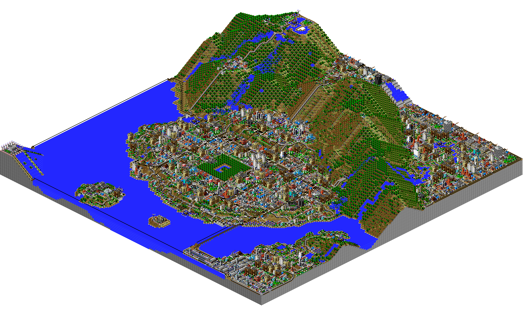
Comment by sgt 3 hours ago
Comment by notpushkin 3 hours ago
Comment by sgt 3 minutes ago
Comment by EZ-Cheeze 8 hours ago
"Satellite images from highly oblique angles are pretty mindblowing"
If u like this u will like that
Comment by nuwandavek 8 hours ago
Comment by murphyslab 11 hours ago
Comment by tamimio 10 hours ago
Comment by murphyslab 10 hours ago
Naruto: https://floor796.com/#t2l4,684,675
The author continues adding and refining the project, so if it isn't in there yet, perhaps in the future.
Comment by tamimio 10 hours ago
Comment by smusamashah 10 hours ago
Comment by codetiger 6 hours ago
Comment by tda 4 hours ago
Comment by codetiger 4 hours ago
Comment by Palomides 36 minutes ago
I suppose that explains the yellow filter and the mixels
Comment by jtfrench 10 hours ago
Comment by nuwandavek 8 hours ago
Comment by cpfohl 37 minutes ago
Comment by cyanregiment 8 hours ago
There are also a few massive square ponds in the Tenderloin that I am pretty sure do not exist lol
But I like the idea.
Comment by nuwandavek 8 hours ago
Planning to fix in the next version!
Comment by accrual 11 hours ago
Comment by yreg 5 hours ago
What's the consensus on sharing the stylized assets created by diffusion models based on reference photos from e.g. Google Earth? Can the final output be shared as public domain or do Google, Airbus, et al. still hold some rights over them?
Comment by jcarrano 4 hours ago
Comment by qurren 9 hours ago
Comment by wxw 10 hours ago
This could be a great anecdotal benchmark for agent/model progress. I wonder how much easier things have gotten with the latest Codex/Claude vs. when isometric.nyc was made.
Comment by flomo 9 hours ago
Also, I would love to zoom in more. (pls give me the pixels)
Comment by nuwandavek 8 hours ago
I think a better data distribution should eliminate this. Also, my "water detector" was not too good and could be improved.
I wrote about a few of these things here: https://sf.isopolis.city/dev.html
Comment by nuwandavek 8 hours ago
Comment by mnky9800n 5 hours ago
Comment by bestony 10 hours ago
Comment by montag 10 hours ago
Comment by nuwandavek 8 hours ago
I tried out a few ideas, but i think better training data around water will help a LOT.
Comment by toplinesoftsys 9 hours ago
Comment by harrisonpage 11 hours ago
Comment by nuwandavek 8 hours ago
Comment by nuwandavek 8 hours ago
Comment by burnoutdv 4 hours ago
Like the new york one, its just...unpolished. I dare to say slop. I am sure the author put some effort into it, BUT its just not there for me. The wiggly lines, the blurry designs and just everything. With something is pixelart or appears to be, I expected it to be pixel perfect, not just some random picture that looks like pixelart on the first glance.
The idea feels neat, but the execution needs so much more touch and polish. Maybe even handcrafting to be impressive.
Comment by greatony 12 hours ago
Comment by nuwandavek 8 hours ago
Comment by hasyimibhar 5 hours ago
Comment by jullls 3 hours ago
Comment by quemtrouxe 2 hours ago
Comment by danenania 10 hours ago
Comment by nuwandavek 8 hours ago
Comment by Zaheer 7 hours ago
Comment by chaostheory 7 hours ago
Comment by nee_oo_ru 10 hours ago
Comment by astaka 7 hours ago
Comment by digg99 1 hour ago
Comment by j117noai 11 hours ago
Comment by vortegne 6 hours ago
Comment by receptopalak 4 hours ago
Comment by nerdsniper 11 hours ago